Coming Soon: Mapulus for Construction Developers
Bring contextual geospatial intelligence to your next project
Mapulus adds context and foresight to site selection.
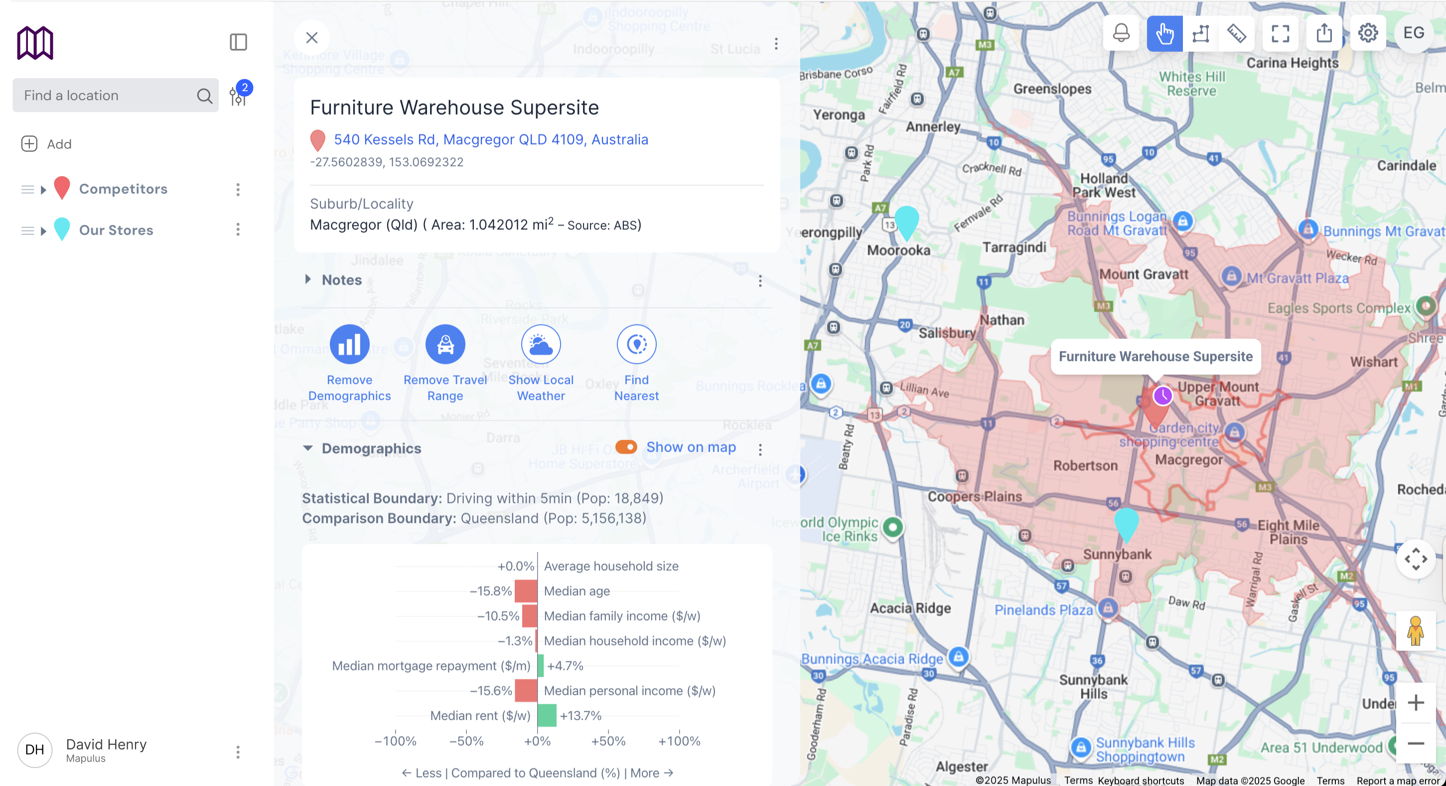
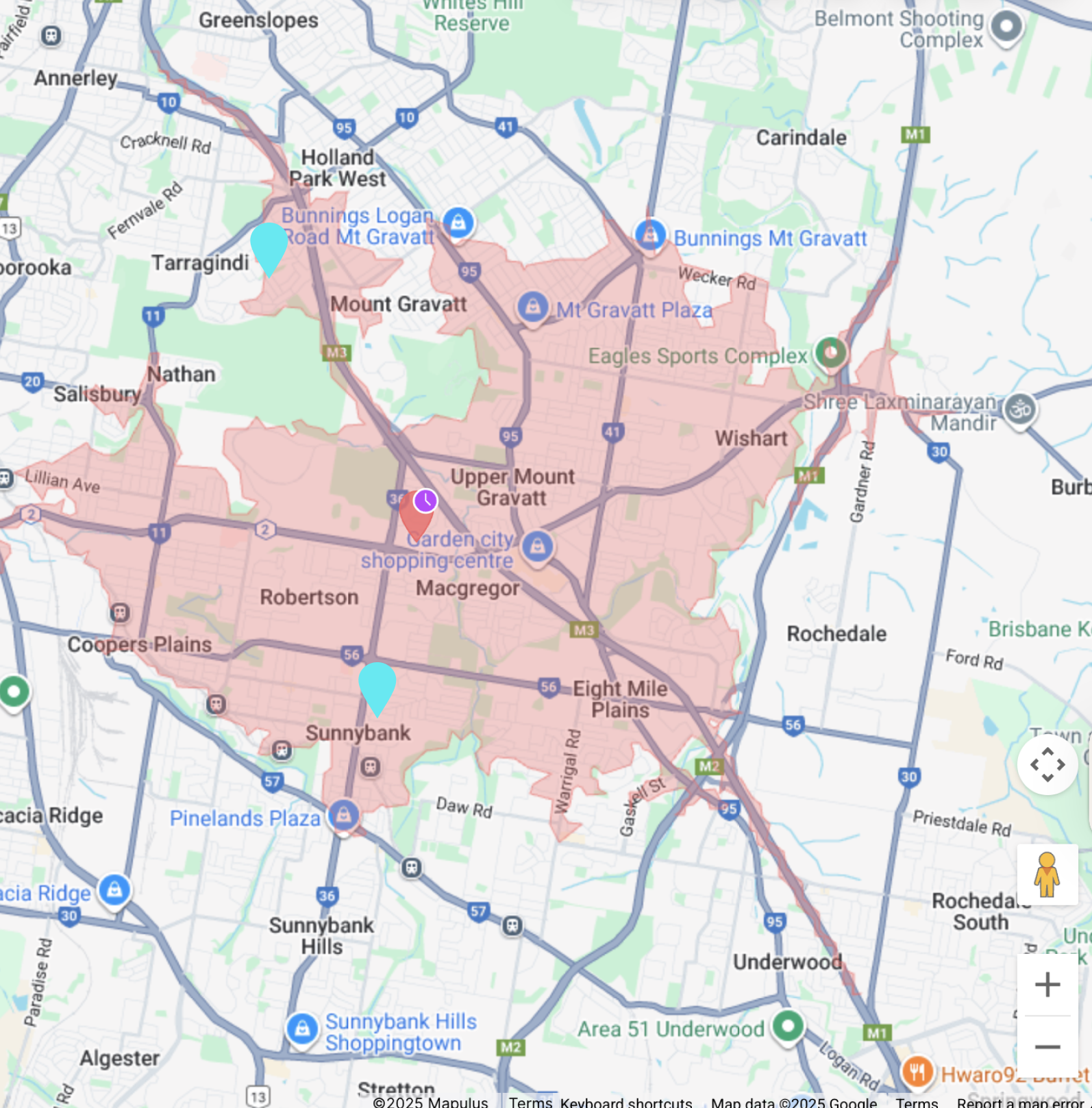
Go beyond "gut feel" — combine demographics, competitor activity, infrastructure, and environmental signals to know not just where to build, but what to build.
Choosing land without knowing future demand drivers
Misjudging property type (oversupply of apartments vs. shortage of townhouses)
Underestimating flood zones, access constraints, or nearby disruptive projects
Relying on broad market reports instead of hyperlocal data
See projected demand by property type—apartments, townhouses, or detached homes—to maximize your return on investment.
Identify which sites are most resilient to environmental risks and market changes to reduce future losses and optimize staging.
Access hard data on demographics, competitor activity, and market trends to build compelling, evidence-based investment cases.
Visualize demand patterns, competitor developments, and risk factors on one intelligent map to make confident site selection decisions.
See where demand for specific property types is strongest based on demographics and market dynamics.
Layer transport, schools, retail, and planned infrastructure to identify prime development opportunities.
Track existing and pipeline developments to avoid oversupply and find market gaps.
Environmental hazards, flood zones, and planning constraints visualized instantly.
Predict the best type of property (apartments, townhouses, detached homes) based on shifting demographics, incomes, and local competitor stock.
Identify high-potential land parcels by layering transport, schools, retail, and infrastructure projects.
Spot where rival developments are clustered, and where gaps remain.
Weather (already in Mapulus), flood zones, noise corridors, and planning constraints at a glance.
Compare "what if we build X here vs. Y there" on a live map.
Site projects where demand will grow, not shrink
No "wrong product, wrong place" mistakes in asset mix
By 50% with automated location insights
With defensible, data-backed recommendations
We combine government census data, infrastructure plans, competitor listings, environmental hazards, and real-time market activity to provide comprehensive insights.
Our models combine demographic trends, economic indicators, and supply pipeline data to achieve 85%+ accuracy in 12-month demand projections.
Yes, compare unlimited development scenarios side-by-side, testing different property mixes, staging plans, and market timing strategies.
Demographics update quarterly, competitor data refreshes weekly, infrastructure projects update monthly, and environmental data is real-time.
Yes, we provide nationwide coverage with particularly detailed insights for major metropolitan areas and growth corridors.
Yes, generate professional feasibility reports with maps, data tables, and analysis ready for board presentations or investor meetings.
This sets Mapulus apart from generic "GIS platforms" — you're not selling maps, you're selling certainty in site selection and property type decisions.
Early Access for Developers & Investors