Mapulus Help Centre
- Support >
- Admins Controlling Map Editing Permissions in Mapulus
Admins Controlling Map Editing Permissions in Mapulus
Ensure your maps reflect the right level of collaboration with editing restrictions.
Mapulus provides a versatile environment for spatial data analysis and visual representation. Understanding that different projects require varying levels of collaboration, Mapulus introduces an intuitive way for admins to control whether non-admin users can edit a map. This feature allows for better-managing user roles and responsibilities, preventing unauthorised edits and maintaining the integrity of your spatial data.
Whether creating a new map for your team or modifying an existing one, you can set the editing permissions to ensure that only those with the appropriate level of access can make changes. Here’s how you can set or update the editing restrictions to admin-only.
Creating a New Map with Admin-Only Editing
When you’re creating a new map, you have the option to restrict editing from the get-go.
- Navigate to the account home screen.
- Click on the option to create a new map.
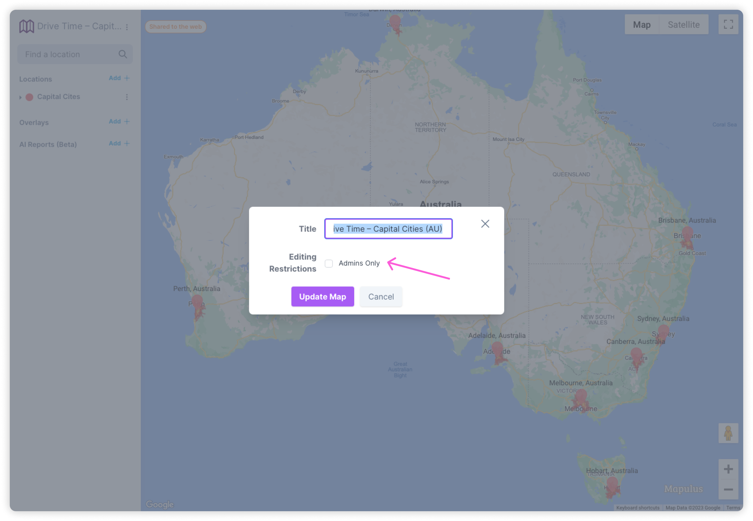
- In the map creation settings, locate the ‘Editing Restrictions’ section.
- Toggle the ‘Admin Only’ option to ensure that only users with admin privileges can edit the map.
Setting these permissions at the creation stage allows you to start your project with the necessary security measures.

Updating Existing Map Permissions
If you need to change the permissions for a map that’s already in use, follow these steps:
- Find the map you wish to edit on the account home screen.
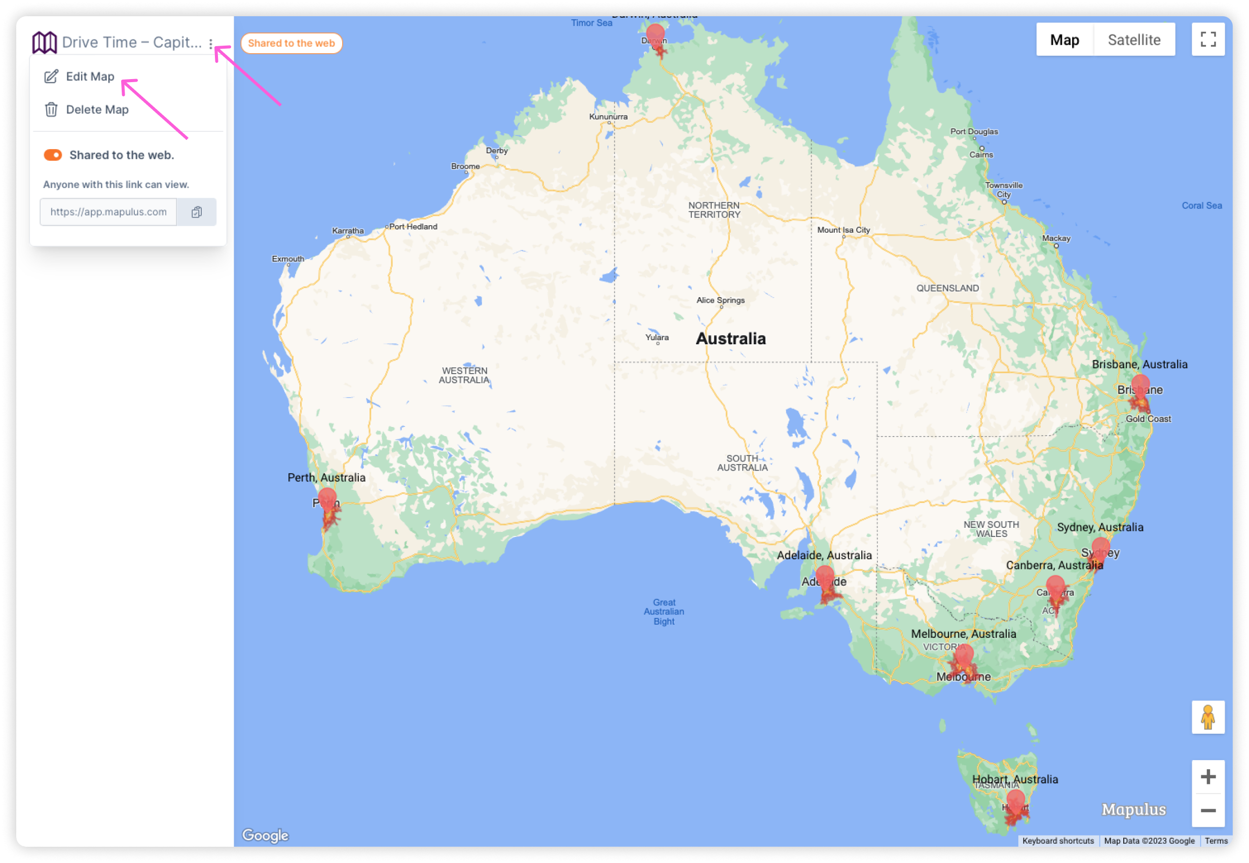
- Tap on the three vertical dots on the map card or access the editing options when you’re in the map by tapping the pencil icon or three dots next to the map’s name in the top left corner.
- Select ‘Edit Map’ or a similarly named option to access the map settings.
- Look for the ‘Editing Restrictions’ toggle and adjust it to ‘Admin Only’ to restrict editing access to non-admins.


What Happens After Changing Editing Permissions?
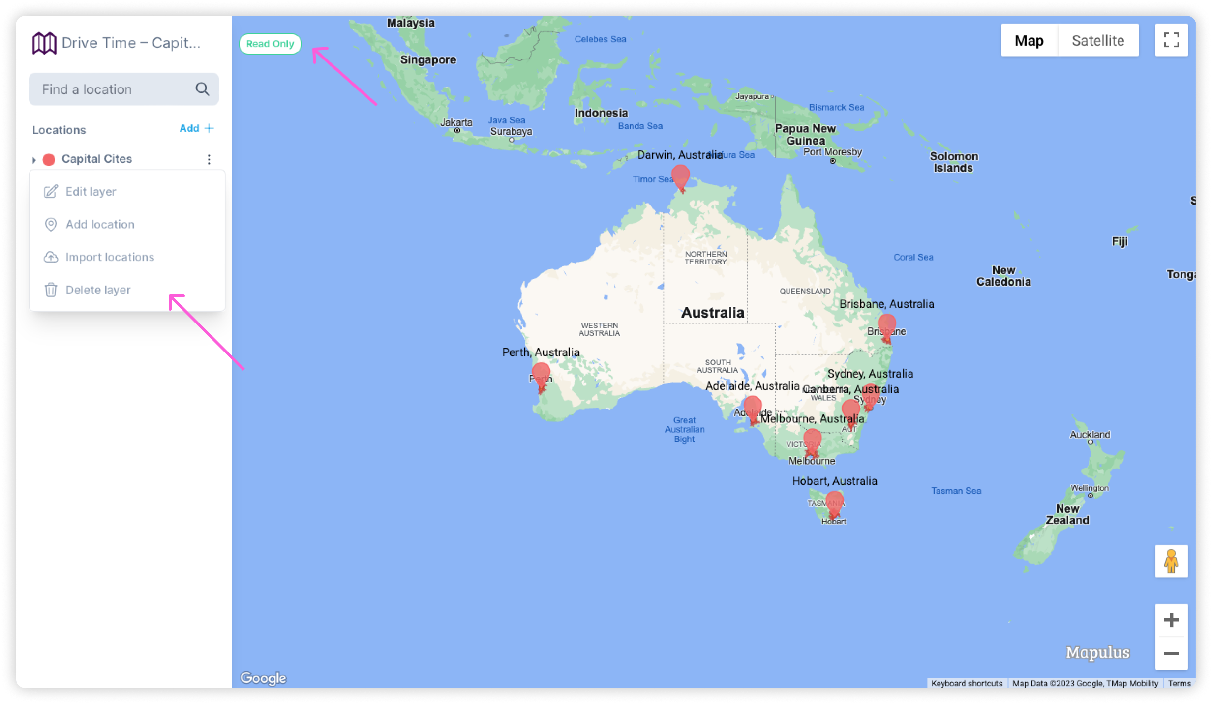
After you’ve toggled the editing restrictions to admin only, all non-admin users will still be able to view the map and use it for analysis or reporting, but they cannot make any changes. Admin users will retain full control over the map’s content and structure, ensuring that edits are made only by authorised personnel.

Remember that communication is key when changing permissions. Inform all users of the permission changes to avoid confusion or workflow interruptions.
Best Practices for Managing Map Editing Permissions
- Assess regularly: Review who has editing access to your maps periodically to ensure it aligns with your current team structure and project requirements.
- Inform your team: Whenever you update the permissions, notify all affected users to maintain transparency and workflow efficiency.
- Train your admins: Ensure that your admin users are well-versed in how to edit the map to avoid accidental changes or data integrity issues.
By utilising the admin controls for map editing, you can balance collaboration and control, providing a secure environment for your team to work in Mapulus. Contact our Helpdesk or our knowledge base for more detailed guidance or support.